AGRO-ECOLOGY
The concept of agro-ecological delineations was developed by FAO
with emphasis on comparable agro-climatic parameters to delineate
agriculturally potential areas suitable for particular crops or
combination of crops so that optimum production potential is
achieved.
The significance of homogeneous agricultural
environment, as realised in the agro-ecological unit is of
particular importance in effective and sustainable land use and
its management to enhance agricultural output for meeting the
increasing demand for food, fodder, fibre and other products. With
the growing demand for food, fodder and fibre, there is overuse of
land or faulty planning of land use that has resulted in soil
health hazards such as acidification, soil erosion and
deterioration of land quality.
The
agro-ecological delineations of Kerala has been undertaken by the
National Bureau of Soil Survey and Land Use Planning, Bengaluru
under a project co-ordinated by the Kerala State Planning Board in 2012.
The analysis was carried out primarily based on climate,
geomorphology, land use and soil variability enabling delineation
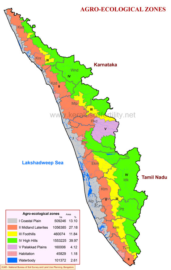
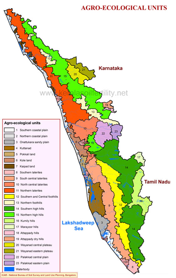
of five agro-ecological zones (AEZ) and twenty three agro-ecological
units (AEU).
Agro Ecological Management Units (AEMU)
Twenty three agro- ecological units have been delineated in Kerala based
on climate, land form and soils with the panchayats as the primary unit.
From the point of view of administrative convenience and implementation of
development plans, it has become necessary to reclassify the existing units
with the development blocks as the unit.
The re grouping has been done by merging of
units with only slight variations in features like climate, land form, soils and limited
geographical extent. Based on the above criteria twenty agro-ecological management units
have been identified.
COASTAL PLAIN
Agro-Ecological Zone
Distribution
Along the coast and lying between the sea and the midlands.
Features
Comprises the nearly level to gently sloping lands along the
coast at elevation below 30 metres Includes sandy
beaches, sandy plains, coastal laterites, and low lying areas
such as estuaries, backwaters, submerged lands, swamps,
marshes, kayal lands, and broad valleys The zone
covers 4,60,074 ha (11.84 %) in the state
MIDLAND LATERITES
Agro-EcologicalZone
Distribution
Extending from the southern end to the northern end of the
state.
Features
Comprises undulating to rolling lands interspersed with narrow
valleys between the coastal plain on the west and foothills and
hills on the east.The elevation ranges from 30 to 300 m
The zone covers 10,56,385 ha (27.18 %)
FOOTHILLS
Agro-Ecological Zone
Distribution
The undulating to rolling lands and low hills between the
midland laterite on the west and high hills on the eastern
side.
Features
The terrain has only very narrow valleys with elevation ranging
from 300 to 600 m The zone covers 4,60,074 ha (11.84
%)
HIGH HILLS
Agro-Ecological Zone
Distribution
Hilly region comprising Western Ghats and plateaus extending
from south to north.
Features
This comprises the largest zone and includes the Western Ghats
and highland plateaus rising 600 m above mean sea level, with a
number of peaks well over 1800 m. The Western Ghats
comprise Central Sahyadri, the Nilgiris and South Sahyadri. The
mountains are essentially plateau remnants of two or three
altitudinal zones. Slopes of hill ranges as high as 80 per cent
is also observed.
The zone covers 15,53,225 ha (39.97
%)
PALAKKAD PLAIN
Agro-Ecological Zone
Distribution
The Palakkad Gap, resembling an inland plain with low
elevation, is a prominent physical feature along the valley of
the Bharathapuzha river.
Features
This comprises of the gently sloping lands of Palakkad, east of
Kuthiran hills, flanked on the south and north by Nelliyampathy
hills and Attappady hills, respectively and merging to Tamil
Nadu uplands through the gap in Western Ghats The zone
covers 1,60,006 ha (4.12 %)
FEATURES OF AGRO ECOLOGICAL UNITS (AEU)
Twenty three agro- ecological units have
been delineated in Kerala based on climate, land form and soils
with the panchayats as the primary unit. From the point of view
of administrative convenience and implementation of development
plans, it has become necessary to reclassify the existing units
with the development blocks as the unit.
The re-grouping has
been done by merging of units with only slight variations in
features like climate, land form, soils and limited
geographical extent. Based on the above criteria twenty
agro-ecological units have been identified. The characteristic
features of the Agro-ecological units are described.
SOUTHERN COASTAL PLAIN
Agro-Ecological Unit

Distribution & Extent
The Southern Coastal Plain agro-ecological unit is delineated
to represent the nearly level coastal lands where sands are the
dominant soil type. Coastal sandy soils occupy a narrow strip
of land along the coastline of 3 Blocks (Chirayinkeezh,
Pothencode, Varkala) of Thiruvananthapuram District, 3 Blocks
(Chittumala, Ithikkara, Mukathala) of Kollam District and 2
Blocks ( Kanjikuzhy, Pattanakkad) of Alappuzha District.
The unit covers 56,782 ha (1.46 %)
Climate
The climate is tropical humid monsoon type with mean annual temperature of 27.6 °C and rainfall of 2360 mm.
Soils & Crops
These soils of marine origin are sandy,
acidic in reaction, have low content of organic matter and are
deficient in most plant nutrients.
They are deep to very deep,
but often limited by high water table. They have rapid
permeability and severe limitation for sustained use under
irrigation. Capacity of these soils to retain plant nutrients
and water are extremely low. Coconut is the dominant crop grown
on these soils with rice in low lands.
External input of lime
and plant nutrients is highly essential to ensure satisfactory
crop production. Onattukara soils are also sandy type and
distributed away from the coast in the Onattukara region
covering parts of Alappuzha and Kollam districts. But for the
slightly higher content of finer soil particles and organic
matter, these soils are similar to coastal sands in general
properties and management requirements. Soils are dominantly
sandy throughout the profile and occur in gently sloping lands
and are prone to severe desiccation and moisture stress during
summer months.
Soil test data of 6816 samples collected from the unit indicated that majority of the soils are slightly acid to neutral. Organic carbon content is low to medium, available P is high and potassium is low to medium. Magnesium is deficient in 98 and sulphur deficient in 51 per cent of soils. Deficiency of boron is wide spread and observed in 80 per cent of soils.
SOIL REACTION (pH)
- Majority of soils (68 %) are slightly acid to neutral (pH 6.1 to 7.3)
MAJOR NUTRIENTS
- Organic carbon content is low in 43 and medium in 44 per cent of samples
- Available P is high in 74 per cent of soils
- Potassium is low in 43 and medium in 32 per cent of samples
SECONDARY NUTRIENT STATUS
- Calcium is adequate in 67 per cent of soil samples
- Magnesium is deficient in 98 per cent of soil samples
- Sulphur is deficient in 51 per cent of soil samples
MICRO NUTRIENT STATUS
- Copper is adequate in 69 per cent of soil samples
- Zinc is adequate in 89 per cent of soil samples
- Boron is deficient in 80 per cent of soil samples
NORTHERN COASTAL PLAIN
Agro-Ecological Unit
Distribution & Extent
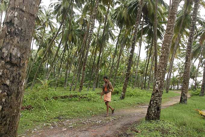
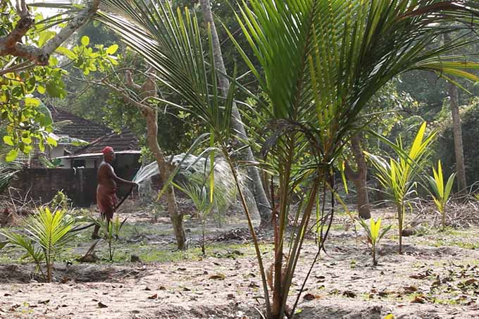
AEU 2 represents the Northern Coastal Plain agro-ecological unit covering 4 Blocks (Chavakkad, Mathilakom, Thalikkulam, Velangaloor) of Thrissur District, 3 Blocks (Thanur, Thirur, Tirurangadi) in Malappuram District, 4 Blocks (Kozhikode, Melady, Panthalayini, Vadakara) of Kozhikode District, 2 Blocks (Kannur and Thalassery) of Kannur District and Kanhangad Block of Kasaragod District. The unit covers 1,22,970 ha (3.16 %)
Climate
The unit with tropical humid monsoon climate having rainfall ranging from 3133 to 3254 mm and mean annual temperature 27.5 °C.
Soils & Crops
The soils of the Northern coastal plain
are of marine origin and are sandy, acidic in reaction with low
content of organic matter and deficient in most of the plant
nutrient.
They are deep to very deep, often limit by high water
table. They have rapid permeability and severe limitation for
sustained use under irrigation. Water and nutrient holding
capacity are low.
External inputs of lime and plant nutrients
are highly essential for satisfactory crop production. Soil
moisture deficit are experienced during summer months with dry
period of around 5 months. The dominant crops include coconut
in the uplands and rice in the lowlands.
Soil test data of 13755 samples collected from the unit indicated that majority of the soils are strongly acid to slightly acid. Organic carbon content is low to medium, available P is high and potassium is low to medium. Magnesium is deficient in 80 per cent of samples. Deficiency of boron is observed in 58 per cent of soils.
SOIL REACTION (pH)
- Majority of the soils (73 %) are strongly acid to slightly acid (pH 5.1 to 6.5)
MAJOR NUTRIENTS
- Organic carbon content is low in 42 and medium in 36 per cent of samples
- Available P is high in 72 per cent of soils
- Potassium is low in 47 and medium in 34 per cent of samples
SECONDARY NUTRIENT STATUS
- Calcium is adequate in 60 per cent of soil samples
- Magnesium is deficient in 80 per cent of soil samples
- Sulphur is adequate in 74 per cent of soil samples
MICRO NUTRIENT STATUS
- Copper is adequate in 83 per cent of soil samples
- Zinc is adequate in 86 per cent of soil samples
- Boron is deficient in 58 per cent of soil samples
ONATTUKARA SANDY PLAIN
Agro-Ecological Unit

Distribution & Extent
The special agro-ecological unit Onattukara Sandy Plain is delineated to cover the sandy plains extending into the midlands from coast and covering 3 Blocks (Chavara, Oachira, Sasthamkotta) of Kollam District and 4 Blocks ( Bharanikavu, Haripad, Mavelikara, Muthukulam) of Alappuzha District. The unit covers 67,447 ha (1.74 %)
Climate
The climate is tropical humid monsoon type (mean annual temperature 27.6 °C; rainfall 2492 mm)
Soils & Crops
The soils are sandy, very deep, well
drained with shallow water table. They are strongly acid.
Increasing sub soil acidity is observed. Soil organic matter is
medium with low nutrient and water holding capacity. Salinity
is a problem in areas adjacent to the coast during summer
months.
Rice is grown in the low lands is subjected to
inundation. Orumundakan lands which form part of the Onattukara
region are distributed in the coastal regions of
Karunagappallytaluk in Kollam District. They are prone to sea
water ingress and are developed from lacustrine deposits,
extremely acidic, very deep with shallow water table and poor
in available nutrients.
Saline resistant rice variety
Orumundakanis cultivated in these region. Coconut is the major
crop in the uplands inter cropped with tapioca, banana and
tuber crops. Rice is cultivated in the lowlands. Sesame is an
important summer crop followed by vegetables.
Soil test data of 8466 samples collected from the unit indicated that majority of the soils are strongly acid to slightly acid. In some regions soils are extremely acid to very strongly acid. Organic carbon content is low to medium, available P is high in 80 per cent of soils and potassium is low in 65 per cent of soils. Calcium is deficient in 91 per cent of soils. Magnesium deficiency is acute and observed in 97 per cent of samples. Sulphur is deficient in 84 per cent of samples. Boron deficiency is observed in 36 per cent of soils.
SOIL REACTION (pH)
- Majority of the soils (55 %) are strongly acid to slightly acid (pH 5.1 to 6.5)
MAJOR NUTRIENTS
- Organic carbon content is low in 48 and medium in 34 per cent of samples
- Available P is high in 80 per cent of soils
- Potassium is low in 65 per cent of samples
SECONDARY NUTRIENT STATUS
- Calcium is deficient in 91 per cent of soil samples
- Magnesium is deficient in 97 per cent of soil samples
- Sulphur is deficient in 84 per cent of soil samples
MICRO NUTRIENT STATUS
- Copper is adequate in 55 per cent of soil samples
- Zinc is adequate in 74 per cent of soil samples
- Boron is adequate in 64 per cent of soil samples
KUTTANAD
Agro-Ecological Unit
Distribution & Extent
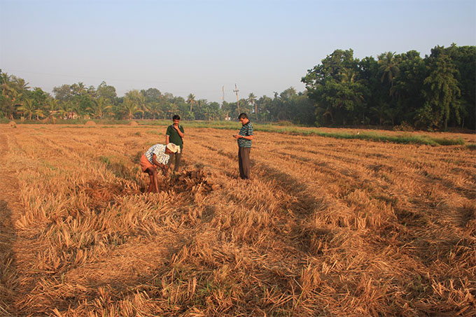
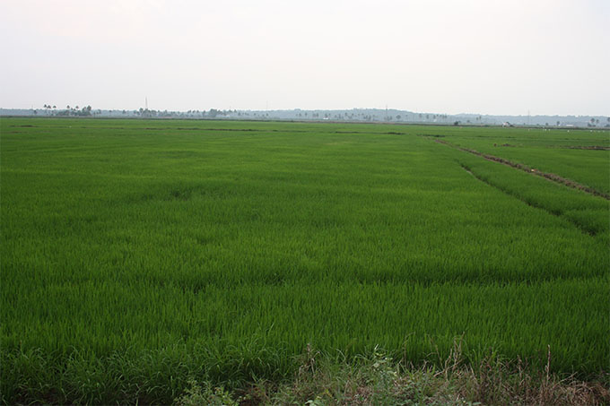
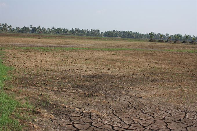
Kuttanad is a special agro-ecological unit delineated to represent the waterlogged lands spread over 6 Blocks (Ambalappuzha, Aryad, Champakkulam, Chenganoor, Thycattussery, Veliyanad) of Alappuzha District, 5 Blocks (Ettumanoor, Kaduthuruthy, Madappally, Pallom, Vaikom) of Kottayam District and Pulikeezhu Block of Pathanamthitta District. Large parts of these lands are below, at or just above sea level. The unit covers 1,26,931 ha (3.27%)
Climate
The climate is tropical humid monsoon type (mean annual temperature 27.6 °C; rainfall 2,746.1 mm).
Soils & Crops
Soils are developed from mixed sediments
of marine and river alluvium. They often contain sulphur
bearing minerals occurring at various depths. These sulphur
rich minerals upon drying produce extreme acidity by oxidation
and hydrolysis. Hence these soils are referred to as potential
acid sulphate soils.
As long as they are kept submerged there
is no danger of their oxidation and conversion to acid sulphate
soils. The sediments and soils of the Kuttanad contain very
high levels organic matter (at places even up to 18 per cent)
in various stages of decomposition. These soils are well
supplied with plant nutrients.
The pH of the soil when measured
in situ, is in the range of 5.5 - 6.5. But sampling, drying and
then measuring the pH in equilibrated water shall record low
readings often lower than 3.5. The ingress of sea water causes
salinity to very high levels. Flushing of the lands by fresh
water during monsoon season reduces the salinity to levels that
permit rice production. In the protected lands, salinity levels
are substantially lower than the unprotected lands. Soils are
dark grey to black in colour.
The subsurface layers are sulphur
rich sediments with yellow mottles of jarosite (basic hydrous
sulphate of potassium and iron) minerals. Soils are poorly
drained with slow permeability (0.5 to 50 cm/hr) and are used
for rice cultivation only under artificial drainage. Based on
differences in hydrologic regime, occurrence of sulphide
bearing minerals, salinity and geographic distribution, soils
of Kuttanad are differentiated as Kayal ,Karappadam and Kari
soils. Kayal soils are developed from reclaimed lake beds in
Kottayam and Alappuzha districts.
They are deep, poorly drained
alluvial soils with silty loam to silty clay loam surface
texture. Sub soils are sandy and show the presence of lime
shell. They are extremely acidic, medium in organic matter
excessively drained with rapid permeability. The Karappadam
soils occur along the banks of inland water ways and rivers.
They are also river borne alluvial soils and located on level
lands one to two meters below sea level.
Soils are deep, poorly
drained with clay loam surface texture and silty clay in the
sub surface. They are extremely acid to strongly acid in the
sub soils due to the presence of decaying organic debris. The
Kari soils have high levels of organic matter reaching upto 18
per cent and sulphur bearing minerals. They are black in color,
poorly drained, heavy textured occurring one to two meters
below sea level.
Sub soils are extremely acidic due to the
presence of decaying organic matter. Draining off the potential
acid sulphate soils results in the oxidation of sulphur rich
sediments resulting in the ultra acid condition. Sea water
ingress is a major problem and is controlled through bunds and
barrages to facilitate rice cultivation. Coconut is grown on
the uplands and bunds of the unit.
Soil test data of 12145 samples collected from the unit indicated that majority of the soils are very strongly acid to moderately. Organic carbon content is medium to high, available P high and potassium medium to high. Calcium is deficient in 52 and magnesium deficient in 91 per cent of samples. Deficiency of boron is observed in 57 per cent of samples.
SOIL REACTION (pH)
- Majority of the soils (69 %) are strongly acid to moderately acid (pH 4.5 to 6.0)
MAJOR NUTRIENTS
- Organic carbon content is medium in 31 and high in 41 per cent of samples
- Available phosphorus is high in 74 per cent of soils
- Available potassium is medium in 42 and high in 30 per cent of samples
SECONDARY NUTRIENT STATUS
- Calcium is deficient in 52 per cent of soil samples
- Magnesium is deficient in 91 per cent of soil samples
- Sulphur is adequate in 77 per cent of soil samples
MICRO NUTRIENT STATUS
- Copper is adequate in 81 per cent of soil samples
- Zinc is adequate in 83 per cent of soil samples
- Boron is deficient in 57 per cent of soil samples
POKKALI LANDS
Agro-Ecological Unit

Distribution & Extent
Pokkali Lands, another special agro-ecological unit, are delineated to cover the water logged lowlands, often below sea level and occur in the coastal areas distributed in 4 Blocks (Edappally, Palluruthy, Paravoor, Vypin) of Ernakulam District. The unit covers 39,765 ha (1.02 %)
Climate
The climate is tropical humid monsoon type (mean annual temperature 27.6 °C; rainfall 3,049 mm).
Soils & Crops
Pokkali soils are developed from mixed
marine and riverine alluvium and do not have any protection
from ingress of sea water. Hydrology and soils are similar to
those in Kuttanad. Soil salinity is severe, except for a short
period after flushing of the sea water by fresh water from
monsoon. These soils are deep to very deep, have very high
organic matter content and are well supplied with plant
nutrients.
Soils are dark grey to black in colour and have clay
texture and massive structure throughout the profile. Soils are
sandy and imperfectly drained with poor drainage occurring 1 to
2 m below sea level. Soil and sediments contain enough
sulphidic materials and hence are potential acid sulphates. The
area has the characteristic Pokkali rice cultivation using
saline resistant varieties, followed by fish culture. Coconut
is raised on uplands and rice cultivation in lowlands.
Soil test data of 2447 samples collected from the unit indicated that majority of the soils are moderately acid to neutral. However, strongly acid soils also occur in some areas. Organic carbon content is low to medium, available P high and potassium low to medium. Magnesium is deficient in 72 per cent of samples. Deficiency of boron is observed in 64 per cent of soil samples.
SOIL REACTION (pH)
- Majority of the soils (70 %) are moderately acid to neutral (pH 5.6 to 7.3)
MAJOR NUTRIENTS
- Organic carbon content is low in 48 and medium in 38 per cent of samples
- Available phosphorus is high in 84 per cent of soils
- Available potassium is low in 35 and medium in 431 per cent of samples
SECONDARY NUTRIENT STATUS
- Calcium is adequate in 70 per cent of soil samples
- Magnesium is deficient in 72 per cent of soil samples
- Sulphur is adequate in 86 per cent of soil samples
MICRO NUTRIENT STATUS
- Copper is adequate in 81 per cent of soil samples
- Zinc is adequate in 92 per cent of soil samples
- Boron is deficient in 64 per cent of soil samples
THE KOLE LANDS
Agro-Ecological Unit

Distribution & Extent
The Kole Lands agro-ecological unit, spread over the coastal part of 5 Blocks (Anthikkad, Cherpu, Irinjalakkuda, Mullassery, Puzhackal) of Thrissur District and 2 Blocks (Perumpadappu, Ponnani) of Malappuram District. The unit covers 71,142 ha (1.83 %)
Climate
The climate is tropical humid monsoon type (mean annual temperature 27.6 °C; rainfall 2,902 mm).
Soils & Crops
These lands are for most part below sea
level. Seawater ingress into these lands is controlled through
barrages and weirs to facilitate rice cultivation. The soils
are hydromorphic acid clays, often underlain by potential
acid-sulphate sediments and have characteristics similar to
Kuttanad.
Soils are deep with surface soils having silty clay
to clay texture. Sub soils are clayey with highly decomposed
organic debris causing ultra acid condition. They are poorly
drained with slow permeability and have severe limitations for
use under irrigation. Coconut is grown on the uplands of the
unit and bunds and rice in lowlands.
Soil test data of 5056 samples collected from the unit indicated that majority of the soils are strongly acid to slightly acid. However, soils with extremely acid to very strongly acid reaction also occur in some areas. Organic carbon content is low to medium, available P high and potassium low to medium. Magnesium is deficient in 84 per cent of samples. Deficiency of boron is observed in 42 per cent of soil samples.
SOIL REACTION (pH)
- Majority of the soils (62 %) are strongly acid to slightly acid (pH 5.1 to 6.5)
MAJOR NUTRIENTS
- Organic carbon content is low in 36 and medium in 42 per cent of samples
- Available phosphorus is high in 85 per cent of soils
- Available potassium is low in 30 and medium in 41 per cent of samples
SECONDARY NUTRIENT STATUS
- Calcium is adequate in 60 per cent of soil samples
- Magnesium is deficient in 84 per cent of soil samples
- Sulphur is adequate in 81 per cent of soil samples
MICRO NUTRIENT STATUS
- Copper is adequate in 84 per cent of soil samples
- Zinc is adequate in 89 per cent of soil samples
- Boron is adequate in 58 per cent of soil samples
KAIPAD LANDS
Agro-Ecological Unit
Distribution & Extent
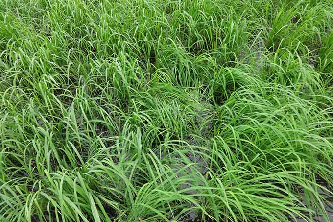
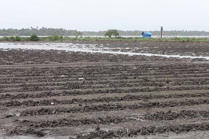
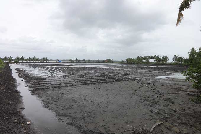
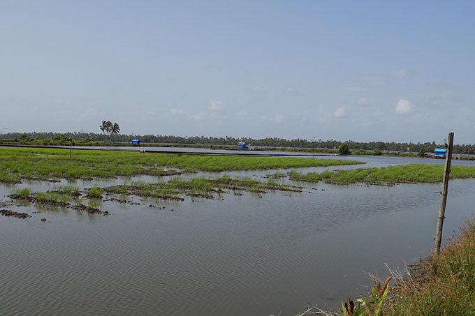
AEU 7 represents the Kaippad lands agro-ecological units along the coast of Kozhikode, Kannur and Kasaragod districts as isolated stretches of water logged lands. The unit covers Quilandy Municipality in Kozhikode District, Kalliasseri Block of Kannur District and Neeleswaram Block of Kasaragod District. The unit covers 24,209 ha (0.62 %)
Climate
The climate is tropical humid monsoon type having rainfall of 3254 mm and mean annual temperature 27.3 °C. The low lands often are below sea level and do not have protection against sea water inundation.
Soils & Crops
The soils of the Kaippad lands are of marine origin and are hydromorphic, acid-saline, clayey and underlain by potential acid sulphate sediments. The high salinity levels occurring are washed out during monsoon season permitting cultivation of rice. Soils are rich in organic matter and fertile.
Soil test data of 2560 samples collected from the unit indicated that majority of the soils are strongly acid to slightly acid. Organic carbon content is low to medium, available P is high and potassium is low to medium. Magnesium is deficient in 89 per cent of samples. Deficiency of boron is observed in 42 per cent of soils.
SOIL REACTION (pH)
- Majority of the soils (55 %) are strongly acid to moderately acid (pH 5.1 to 6.0)
MAJOR NUTRIENTS
- Organic carbon content is low in 46 and medium in 33 per cent of samples
- Available phosphorus is high in 71 per cent of soils
- Available potassium is low in 50 and medium in 36 per cent of samples
SECONDARY NUTRIENT STATUS
- Calcium is adequate in 64 per cent of soil samples
- Magnesium is deficient in 89 per cent of soil samples
- Sulphur is adequate in 67 per cent of soil samples
MICRO NUTRIENT STATUS
- Copper is adequate in 81 per cent of soil samples
- Zinc is adequate in 84 per cent of soil samples
- Boron is adequate in 58 per cent of soil samples
SOUTHERN LATERITES
Agro-Ecological Unit
Distribution & Extent
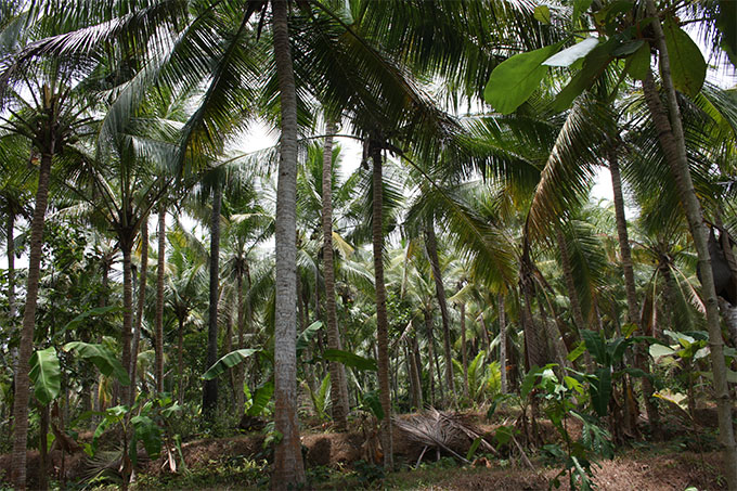
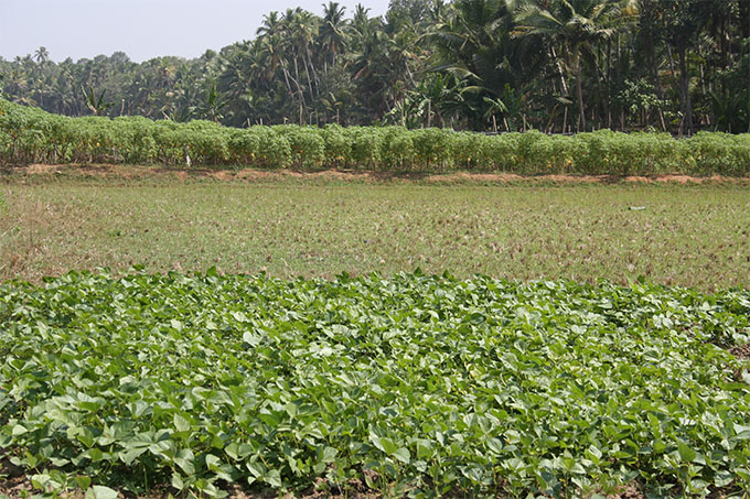
The Southern Laterites agro-ecological unit spreads over 5 Blocks (Athiyannur, Nemom, Parassala, Perumkadavila, Vellanad) of Thiruvananthapuram District is delineated to represent the uniqueness of climate and soils. The unit covers 38,727 ha (1.0 %)
Climate
The area with tropical moist subhumid monsoon climate receives low rainfall compared to the other areas of midland laterites (mean annual temperature 27.1 °C; rainfall 1,884 mm). However, the well-distributed rainfall from both SW and NE monsoon restricts the dry period to just three months in a year.
Soils & Crops
Soils are deep, well drained, red, non
gravelly having sandy clay to clay in the surface and sandy
clay sub soils. They differ from the other laterite soils of
the state in the absence of gravel and plintite. Soils have low
cation exchange capacity and are distributed in gently sloping
to moderately sloping lands.
They have good structural
characteristics and physical properties and are prone to
erosion. They are well drained with moderate to slow
permeability and experience water stress during December to
March. Coconut on uplands intercropped to a variety of annual
and other perennial crops and rice, tapioca, banana and
vegetables on lowlands are the major land uses.
Soil test data of 5917 samples collected from the unit indicated that majority of the soils are strongly acid to slightly acid. Organic carbon content is low to medium, available P high and potassium medium to high. Magnesium is deficient in 95 per cent of samples. Deficiency of boron is observed in 51 per cent of soil samples.
SOIL REACTION (pH)
- Majority of the soils (68 %) are strongly acid to slightly acid (pH 5.1 to 6.5)
MAJOR NUTRIENTS
- Organic carbon content is low in 39 and medium in 44 per cent of samples
- Available phosphorus is high in 56 per cent of soils
- Available potassium is medium in 35 and high in 37 per cent of samples
SECONDARY NUTRIENT STATUS
- Calcium is adequate in 75 per cent of soil samples
- Magnesium is deficient in 95 per cent of soil samples
- Sulphur is adequate in 98 per cent of soil samples
MICRO NUTRIENT STATUS
- Copper is adequate in 67 per cent of soil samples
- Zinc is adequate in 72 per cent of soil samples
- Boron is deficient in 51 per cent of soil samples
SOUTH CENTRAL LATERITES
Agro-Ecological Unit

Distribution & Extent
The South Central Laterites agro-ecological unit spreads over 3 Blocks (Kilimanoor, Nedumangad, Vamanapuram) of Thiruvananthapuram District, 3 Blocks ( Chadayamangalam, Kottarakkara, Vettikkavala) of Kollam District, 5 Blocks (Elanthur, Koipram, Mallappally, Pandalam, Parakode) of Pathanamthitta District, 4 Blocks (Lalam, Pampady, Uzhavoor, Vazhoor) of Kottayam District, 7 Blocks ( Alangad, Angamaly, Mulamthuruthy, Pampakuda, Parakadavu, Vadavucode, Vazhakkulam) of Ernakulam District. The unit covers 3,65,932 ha (9.42 %)
Climate
The climate is tropical humid monsoon type with mean annual temperature of 26.5°C and rainfall 2827 mm.
Soils & Crops
Laterite soils are the most extensive in
the State covering almost entire midlands, part of coastal
lands and Wayanad Plateau and occupy the major portion of the
agro ecological unit. Lateritisation, a typical soil process in
tropical humid climate, involves leaching loss of bases and
silica and residual accumulation of oxides of iron and
aluminium. Intense lateritisation has obliterated much of the
differences in soil parent material.
The soils are often deep
to very deep,gravelly, sandy clay loam to gravelly clay surface
texture, well drained, acid clay with plinthite occurring at
various depths, depending on erosion history. The soils are
extremely gravelly in the surface and shows wide variation
within the profile.
The low activity clay is mostly kaolinite
type with very low cation exchange capacity. The strongly acid
soils have low reserves of bases and deficient in plant
nutrients. They have good structural characteristics due to the
presence of oxides of iron and aluminium and are well drained
and have moderate permeability with fairly good air water
relationships.
Laterite soils present serious constraints to
crop production viz., gravelliness, low water retention, strong
soil acidity, low organic matter content, low base saturation,
aluminium toxicity, low plant nutrient retention,
multi-nutrient deficiency, high phosphorus fixing capacity and
very low levels of weatherable minerals.
However, protected
from erosion and with adequate external inputs (lime, organic
matter, macro, secondary and micronutrients) the laterite soils
can support very high biomass production with plantation and
annual crop production systems.
They are distributed on
moderately steep to steep sloping lands and are prone to
erosion. Rubber,coconut intercropped to a variety of annual and
other perennial crops is the major land use on uplands and
rice, tapioca, banana and vegetables on lowlands.
Soil test data of 30664 samples collected from the unit indicated that majority of the soils are very strongly acid to strongly acid. Organic carbon content is medium to high, available P is high in 68 per cent of soils and potassium is medium to high. Magnesium is deficient in 61 per cent and boron is deficient in 65 per cent of soil samples.
SOIL REACTION (pH)
- Majority of soils (57 %) are very strongly acid to strongly (pH 4.5 to 5.5)
MAJOR NUTRIENTS
- Organic carbon content is medium in 46 and high in 37 per cent of samples
- Available phosphorus is high in 68 per cent of soils
- Available potassium is medium in 40 and high in 41 per cent of samples
SECONDARY NUTRIENT STATUS
- Calcium is adequate in 70 per cent of soil samples
- Magnesium is deficient in 61 per cent of soil samples
- Sulphur is adequate in 80 per cent of soil samples
MICRO NUTRIENT STATUS
- Copper is adequate in 78 per cent of soil samples
- Zinc is adequate in 87 per cent of soil samples
- Boron is deficient in 65 per cent of soil samples
NORTH CENTRAL LATERITES
Agro-Ecological Unit

Distribution & Extent
This comprises of Northern Laterites and
North Central Laterites agro-ecological units and is delineated
to represent midland laterite terrain with longer dry period
than its southern counterpart. The regrouping has been done
based on similarities in the characteristics with block as the
base unit.
It is spread over 7 Blocks (Chalakkudy, Chowwannur,
Kodakara, Ollukkara, Pazhayannur, Vadakkancherry, Mala) of
Thrissur District, 4 Blocks (Ottappalam, Pattambi,
Sreekrishnapuram, Thrithala) of Palakkad District, 8 Blocks
(Areekode, Kondotty, Kuttippuram, Malappuram, Mankada,
Perinthalmanna, Vandoor, Vengara) of MalappuramDistict, 8
Blocks (Balussery, Chelannur, Koduvally, Kunnamangalam,
Kunnummel, Perambra, Thodannur, Thuneri) of Kozhikode District,
4 Blocks (Edakkad, Koothuparamba, Pannoor, Payyannur) of Kannur
District and 4 Blocks (Karadka, Kasaragod, Manjeswaram,
Parappa) of Kasaragod District. These units cover 6,31,726 ha
(16.77 %)
Climate
The climate is tropical humid monsoon type with mean annual temperature 27.5°C and rainfall ranging from 2795 to 3217 mm ).
Soils & Crops
Laterite soils are the most extensive in
the unit covering almost entire midlands, part of coastal
lands.They show slight variations in morphology and
physic-chemical characteristics. Lateritisation, a typical soil
process in tropical humid climate, involves leaching loss of
bases and silica and residual accumulation of oxides of iron
and aluminium. The soils are often deep to very deep, well
drained, acidic, sesquioxiderich clay with plinthite occurring
at various depths.
The soils are extremely gravelly in the
surface and shows wide variation within the profile. The
strongly acid soils have low reserves of basic cations and they
suffer from multi-nutrient deficiencies. Soil structure is
good, implying good air water relationships. In profiles with
plinthite layer, root penetration is very difficult. Relatively
heavy and hard plinthite is observed in northern Kerala,
compared to south, possibly due to longer dry period in the
former.
In northern Kerala, severe erosion has brought the
plinthite layer to the surface in many landscapes, especially
the nearly level lands on top of undulating hills. Exposure to
air and alternate wetting and drying resulted in irreversible
hardening of plinthite to iron stone/duricrusts. Iron stone
capped, nearly flat top of rolling hills is quite extensive in
Malappuram, Kannur and Kasaragod districts.
Laterite soils
present serious constraints to crop production viz.,
gravelliness, low water retention, strong soil acidity, low
organic matter content, low base saturation, aluminium
toxicity, low plant nutrient retention, multi-nutrient
deficiency, high phosphorus fixing capacity and very low levels
of weatherable minerals.
Moisture stress is experienced for a
period of 4 to 6 months Coconut intercropped to a variety of
annual and other perennial crops is the major land use on
uplands and rice, tapioca, banana and vegetables on lowlands.
Cashew and rubber plantations are also extensive on uplands.
Soil test data of 45447 samples collected from the unit indicated that majority of the soils are very strongly acid to strongly acid. Organic carbon content is medium to high, available P high and available potassium low to medium. Magnesium is deficient in 71 per cent of samples. Deficiency of boron is observed in 53 per cent of soil samples.
SOIL REACTION (pH)
- Majority of the soils (60 %) are very strongly acid to strongly acid (pH 4.5 to 5.5)
MAJOR NUTRIENTS
- Organic carbon content is medium in 46 and high in 33 per cent of samples
- Available phosphorus is high in 56 per cent of soils
- Available potassium is low in 33 and medium in 37 per cent of samples
SECONDARY NUTRIENT STATUS
- Calcium is adequate in 68 per cent of soil samples
- Magnesium is deficient in 71 per cent of soil samples
- Sulphur is adequate in 68 per cent of soil samples
MICRO NUTRIENT STATUS
- Copper is adequate in 90 per cent of soil samples
- Zinc is adequate in 91 per cent of soil samples
- Boron is deficient in 53 per cent of soil samples
NORTHERN LATERITES
Agro-Ecological Unit
Distribution & Extent
This comprises of Northern Laterites and
North Central Laterites agro-ecological units and is delineated
to represent midland laterite terrain with longer dry period
than its southern counterpart. The regrouping has been done
based on similarities in the characteristics with block as the
base unit.
It is spread over 7 Blocks (Chalakkudy, Chowwannur,
Kodakara, Ollukkara, Pazhayannur, Vadakkancherry, Mala) of
Thrissur District, 4 Blocks (Ottappalam, Pattambi,
Sreekrishnapuram, Thrithala) of Palakkad District, 8 Blocks
(Areekode, Kondotty, Kuttippuram, Malappuram, Mankada,
Perinthalmanna, Vandoor, Vengara) of MalappuramDistict, 8
Blocks (Balussery, Chelannur, Koduvally, Kunnamangalam,
Kunnummel, Perambra, Thodannur, Thuneri) of Kozhikode District,
4 Blocks (Edakkad, Koothuparamba, Pannoor, Payyannur) of Kannur
District and 4 Blocks (Karadka, Kasaragod, Manjeswaram,
Parappa) of Kasaragod District. These units cover 6,31,726 ha
(16.77 %)
Climate
The climate is tropical humid monsoon type with mean annual temperature 27.5°C and rainfall ranging from 2795 to 3217 mm ).
Soils & Crops
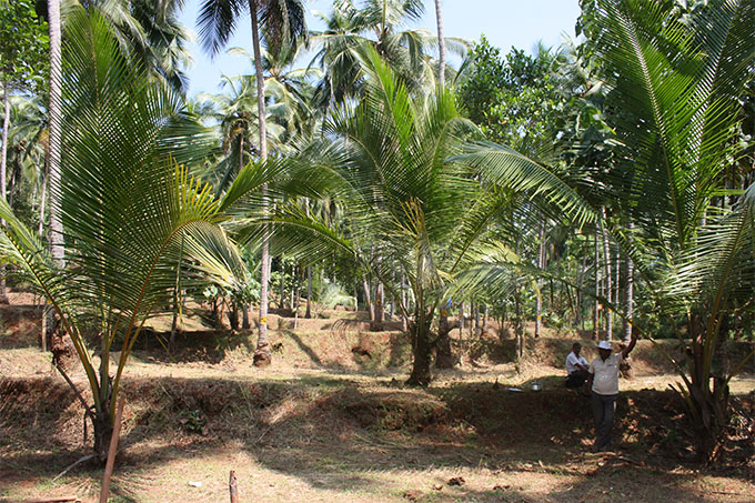
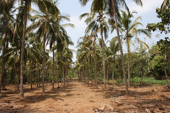
Laterite soils are the most extensive in
the unit covering almost entire midlands, part of coastal
lands.They show slight variations in morphology and
physic-chemical characteristics. Lateritisation, a typical soil
process in tropical humid climate, involves leaching loss of
bases and silica and residual accumulation of oxides of iron
and aluminium.
The soils are often deep to very deep, well
drained, acidic, sesquioxiderich clay with plinthite occurring
at various depths. The soils are extremely gravelly in the
surface and shows wide variation within the profile. The
strongly acid soils have low reserves of basic cations and they
suffer from multi-nutrient deficiencies. Soil structure is
good, implying good air water relationships. In profiles with
plinthite layer, root penetration is very difficult.
Relatively
heavy and hard plinthite is observed in northern Kerala,
compared to south, possibly due to longer dry period in the
former. In northern Kerala, severe erosion has brought the
plinthite layer to the surface in many landscapes, especially
the nearly level lands on top of undulating hills. Exposure to
air and alternate wetting and drying resulted in irreversible
hardening of plinthite to iron stone/duricrusts.
Iron stone
capped, nearly flat top of rolling hills is quite extensive in
Malappuram, Kannur and Kasaragod districts. Laterite soils
present serious constraints to crop production viz.,
gravelliness, low water retention, strong soil acidity, low
organic matter content, low base saturation, aluminium
toxicity, low plant nutrient retention, multi-nutrient
deficiency, high phosphorus fixing capacity and very low levels
of weatherable minerals.
Moisture stress is experienced for a
period of 4 to 6 months Coconut intercropped to a variety of
annual and other perennial crops is the major land use on
uplands and rice, tapioca, banana and vegetables on lowlands.
Cashew and rubber plantations are also extensive on uplands.
Soil test data of 45447 samples collected from the unit indicated that majority of the soils are very strongly acid to strongly acid. Organic carbon content is medium to high, available P high and available potassium low to medium. Magnesium is deficient in 71 per cent of samples. Deficiency of boron is observed in 53 per cent of soil samples.
SOIL REACTION (pH)
- Majority of the soils (60 %) are very strongly acid to strongly acid (pH 4.5 to 5.5)
MAJOR NUTRIENTS
- Organic carbon content is medium in 46 and high in 33 per cent of samples
- Available phosphorus is high in 56 per cent of soils
- Available potassium is low in 33 and medium in 37 per cent of samples
SECONDARY NUTRIENT STATUS
- Calcium is adequate in 68 per cent of soil samples
- Magnesium is deficient in 71 per cent of soil samples
- Sulphur is adequate in 68 per cent of soil samples
MICRO NUTRIENT STATUS
- Copper is adequate in 90 per cent of soil samples
- Zinc is adequate in 91 per cent of soil samples
- Boron is deficient in 53 per cent of soil samples
SOUTHERN AND CENTRAL FOOTHILLS
Agro-Ecological Unit

Distribution & Extent
The Southern and Central Foothills agro-ecological unit is delineated to represent the undulating lands with low hills, between midland laterites and the high hills of Western Ghats. It covers 2 Blocks (Anchal, Pathanapuram) of Kollam District, 2 Blocks (Konni, Ranni) of Pathanamthitta District, 2 Blocks (Erattupetta, Kanjirappally) of Kottayam District, 2 Blocks ( Elamdesam, Thodupuzha) of Idukki District and 3 Blocks (Koovappady, Kothamangalam, Muvattupuzha) of Ernakulam District. The unit covers 3,15,893 ha (8.13 %)
Climate
The climate is tropical humid monsoon type with mean annual temperature of 27.5 °C and rainfall 3462 mm.
Soils & Crops
The soils are strongly acid, gravelly, lateritic, low-activity, lateritic clay soils are rich in organic matter. The narrow valleys have similar but non-gravelly soils with impeded drainage conditions. Shorter dry period, absence of plinthite layer in soil and higher soil organic matter distinguish the foothills from midland laterites. Rubber and coconut intercropped with a variety of crops, pepper and coffee are cultivated in the uplands. Rice and vegetables are cultivated in the low lands.
Soil test data of 16052 samples collected from the unit indicated that majority of the soils are very strongly acid to strongly acid. Organic carbon content is high, available P high and available potassium medium to high. Magnesium is deficient in 54 per cent of samples. Deficiency of boron is observed in 77 per cent of soil samples.
SOIL REACTION (pH)
- Majority of the soils (55 %) are very strongly acid to strongly acid (pH 4.5 to 5.5)
MAJOR NUTRIENTS
- Organic carbon content is high in 50 per cent of samples
- Available phosphorus is high in 59 per cent of soils
- Available potassium is medium in 38 and high in 43 per cent of samples
SECONDARY NUTRIENT STATUS
- Calcium is adequate in 68 per cent of soil samples
- Magnesium is deficient in 54 per cent of soil samples
- Sulphur is adequate in 77 per cent of soil samples
MICRO NUTRIENT STATUS
- Copper is adequate in 91 per cent of soil samples
- Zinc is adequate in 88 per cent of soil samples
- Boron is deficient in 77 per cent of soil samples
NORTHERN FOOTHILLS
Agro-Ecological Unit

Distribution & Extent
This covers Northern Foot Hills and the Palakkad Central Plain agro-ecological units, distributed in Palakkad central plain and adjacent areas. These units have been merged considering the limited extent of Northern Foot Hills with block as the base unit. It comprises of 45 local bodies in Alathur, Kuzhalmannam, Malampuzha, Mannarkkad, and Nenmara Blocks of Palakkad District. This unit has moderate rainfall and dry period around 5 months and is transitional to the drier eastern plain and humid western part. The unit covers 2,57,138 ha (6.62 %)
Climate
The climate is tropical subhumid to humid monsoon type with mean annual temperature of 27.6 °C and rainfall 1966 mm.
Soils & Crops
Soils are deep, well drained, lateritic, clay to loam texture and are slightly acid or neutral reaction. They are well supplied with bases. The valley soils are have similar characteristics, but with impeded drainage conditions. Coconut intercropped to a variety of annual and perennial crops is the major land use on uplands and rice in lowlands
Soil test data of 6919 samples collected from the unit indicated that majority of the soils are very strongly acid to strongly acid with some areas having slightly acid to neutral soils. Organic carbon content is low to medium, available P is medium to high and potassium is low to medium. Boron is deficient in 51 per cent of soil samples.
SOIL REACTION (pH)
- Majority of the soils (67 %) are very strongly acid to strongly acid (pH 4.5 to 5.5)
MAJOR NUTRIENTS
- Organic carbon content is low in 30 and medium in 48 per cent of samples
- Available phosphorus is medium in 32 and high in 48 per cent of soils
- Available potassium is low in 44 and high in 31 per cent of samples
SECONDARY NUTRIENT STATUS
- Calcium is adequate in 96 per cent of soil samples
- Magnesium is adequate in 80 per cent of soil samples
- Sulphur is adequate in 76 per cent of soil samples
MICRO NUTRIENT STATUS
- Copper is adequate in 96 per cent of soil samples
- Zinc is adequate in 92 per cent of soil samples
- Boron is deficient in 51 per cent of soil samples
SOUTHERN HIGH HILLS
Agro-Ecological Unit

Distribution & Extent
The Southern High Hills agro-ecological unit spreads over Adimaly and Idukki Blocks in Idukki District is delineated to represent the uniqueness of climate and soils. Besides elevation, the steep slopes of the terrain and lower temperatures distinguish the high hills from the foothills and midlands. The unit covers 6,72,675 ha (17.31 %)
Climate
The climate is tropical humid monsoon type with mean annual temperature of 21.6 °C and rainfall of 3602 mm.
Soils & Crops
The steeply sloping hilly terrain has deep, well drained, strongly acid, organic-matter-rich clay soils. While forests cover major part of the unit, rubber, coconut, pepper, tea and coffee are also cultivated in many areas.
Soil test data of 2161 samples collected from the unit indicated that majority of the soils are very strongly acid to strongly acid. Organic carbon, available phosphorus and potassium are high. Magnesium is deficient in 80 and sulphur deficient in 50 per cent of samples. Deficiency of boron is observed in 77 per cent of soil samples.
SOIL REACTION (pH)
- Majority of the soils (79 %) are very strongly acid to strongly acid (pH 4.5 to 5.5)
MAJOR NUTRIENTS
- Organic carbon content is high in 66 per cent of samples
- Available phosphorus is high in 49 per cent of soils
- Available potassium is high in 50 per cent of samples
SECONDARY NUTRIENT STATUS
- Calcium is adequate in 70 per cent of soil samples
- Magnesium is deficient in 80 per cent of soil samples
- Sulphur is deficient in 50 per cent of soil samples
MICRO NUTRIENT STATUS
- Copper is adequate in 92 per cent of soil samples
- Zinc is adequate in 68 per cent of soil samples
- Boron is deficient in 77 per cent of soil samples
NORTHERN HIGH HILLS
Agro-Ecological Unit

Distribution & Extent
This comprises of the Northern High Hills distributed in Malappuram District (Kalikavu and Nilambur Blocks) and Kannur District (Irikkur, Iritty, Peravoor and Thaliparamba Blocks). The unit covers 5,28,434 ha (13.60 %)
Climate
The climate is tropical subhumid to humid monsoon type with mean annual temperature of 27.6 °C and rainfall 1966 mm.
Soils & Crops
Soils are deep, well drained, lateritic, clay to loam texture and are slightly acid or neutral reaction. They are well supplied with bases. The valley soils are have similar characteristics, but with impeded drainage conditions. There is a high probability of soil moisture deficit during summer months and the dry period extends to around 5 months. Coconut intercropped to a variety of annual and perennial crops is the major land use on uplands and rice in lowlands
Soil test data of 7000 samples collected from the unit indicated that majority of the soils are very strongly acid to strongly acid. Organic carbon content is medium to high, available P high and potassium low. Calcium is deficient in 55, magnesium deficient in 78 and sulphur 42 per cent of soil samples. Boron is deficient in 55 per cent of soil samples.
SOIL REACTION (pH)
- Majority of soils (74 %) are very strongly acid to strongly acid (pH 4.5 to 5.5)
MAJOR NUTRIENTS
- Organic carbon content is medium in 40 and high in 39 per cent of samples
- Available phosphorus is high in 60 per cent of soils
- Available potassium is low in 68 per cent of samples
SECONDARY NUTRIENT STATUS
- Calcium is deficient in 55 per cent of soil samples
- Magnesium is deficient in 78 per cent of soil samples
- Sulphur is adequate in 58 per cent of soil samples
MICRO NUTRIENT STATUS
- Copper is adequate in 94 per cent of soil samples
- Zinc is adequate in 90 per cent of soil samples
- Boron is deficient in 55 per cent of soil samples
KUMILY HIGH HILLS
Agro-Ecological Unit
Distribution & Extent
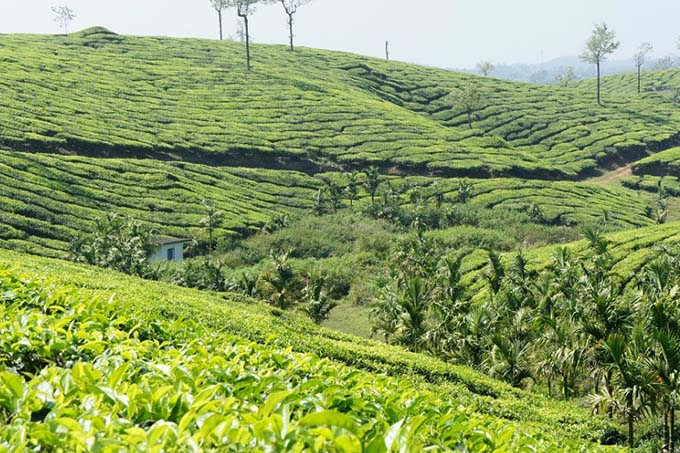
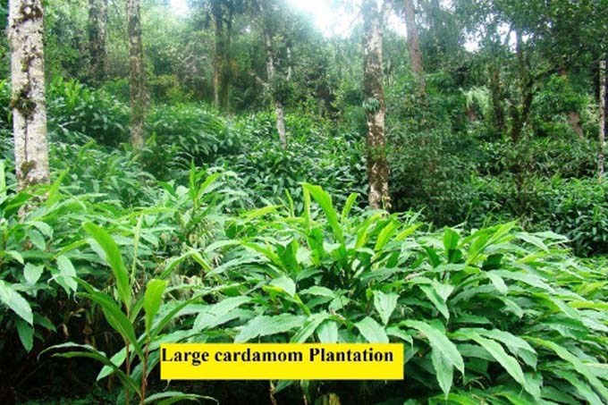
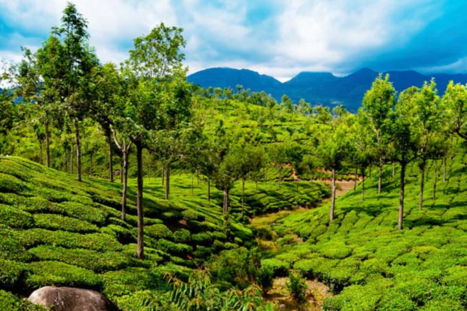
AEU 16 represents the Kumily High Hills covering low rainfall parts of the High hills zone. It spreads over in 20 GramaPanchayats of 3 Blocks (Azhutha, Kattappana and Nedumkandam) in Idukki District. The unit covers 1,50,984 ha (3.81 %)
Climate
The climate is tropical humid monsoon type with mean annual temperature of 22.5 °C and rainfall 1809 mm.
Soils & Crops
Soils of the Kumily High Hills are very deep, well drained, acid, non-gravelly, low-activity clay and rich in organic matter. The lowland valleys are similar in characteristics except for impeded drainage conditions. Soil moisture stress is experienced for 3 to 4 months during summer. Forest covers a substantial area in the unit and major crops are cardamom, tea, coffee, and pepper.
Soil test data of 4434 samples collected from the unit indicated that the soils are very strongly acid to strongly acid. Organic carbon content is high, available P medium to high and available potassium high. Magnesium is deficient in 64 and sulphur deficient in 58 per cent of samples. Deficiency of boron is observed in 77 per cent of soil samples.
SOIL REACTION (pH)
- Majority of the soils (66 %) are very strongly acid to strongly acid (pH 4.5 to 5.5)
MAJOR NUTRIENTS
- Organic carbon content is high in 61 per cent of samples
- Available phosphorus is medium in 25 and high in 45 per cent of soils
- Available potassium is high in 61 per cent of samples
SECONDARY NUTRIENT STATUS
- Calcium is adequate in 82 per cent of soil samples
- Magnesium is deficient in 64 per cent of soil samples
- Sulphur is deficient in 58 per cent of soil samples
MICRO NUTRIENT STATUS
- Copper is adequate in 89 per cent of soil samples
- Zinc is adequate in 74 per cent of soil samples
- Boron is deficient in 77 per cent of soil samples
MARAYUR HILLS
Agro-Ecological Unit
Distribution & Extent
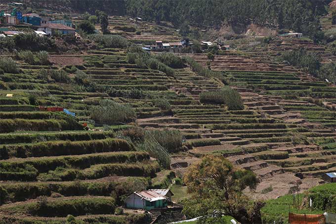
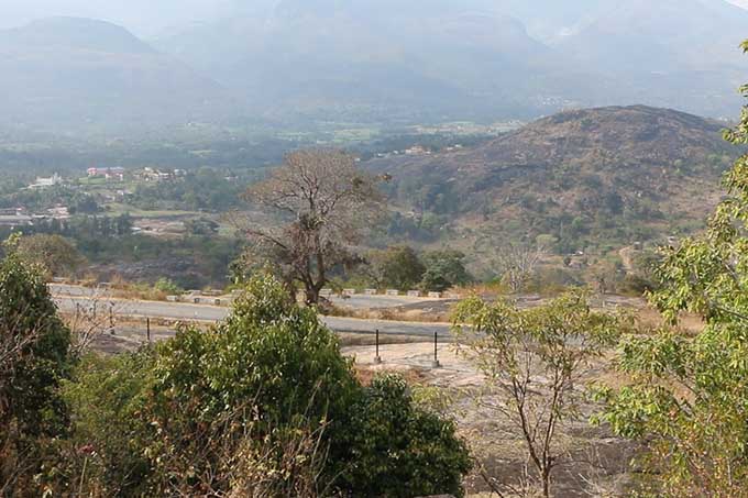
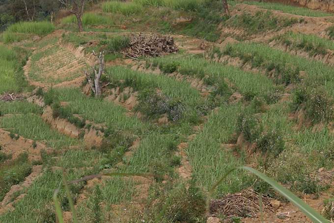
AEU 17 represents the Marayur Dry Hills agro-ecological unit with low rainfall (rain shadow) and covers all the 9 GramaPanchayatsof Devikulam Block in Idukki District.
Climate
The climate is tropical humid monsoon type with mean annual temperature of 23.1°C and rainfall ranges from 1276 to 1809 mm. The low rainfall condition occurs in the rain shadow regions covering Kanthalloor, Vattavada and MarayoorPanchayats. The unit covers 28,968 ha (0.75 %)
Soils & Crops
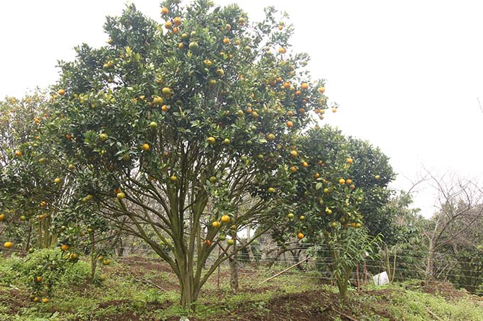
Soils of the Marayur Dry Hills are deep, clay soils, rich in organic matter with slightly acid to neutral reaction and are well supplied with bases. Soil moisture stress is experienced for 3 to 4 months during summer. In addition to the above, soils of the other 6 panchays in Devikulam Block are very deep, well drained, acidic, non-gravelly, low-activity clay and rich in organic matter. The lowland valleys are similar in characteristics except for impeded drainage conditions. Soil moisture stress is experienced for 3 to 4 months during summer. Forest covers a substantial area in the unit and temperate fruits, potato, sugarcane, cool season vegetables are cultivated in uplands and rice in low lands.
Soil test data of 1227 samples collected from the unit indicated that the soils are strongly acid to moderately acid. However, slightly acid to neutral soils also occur in Kanthalloor, Marayoor, Vattavada and Chinnakanal Grama panchayats. Organic carbon content is high, available P medium to high and available potassium medium to high. Magnesium is deficient in 49 and sulphur deficient in 46 per cent of samples. Deficiency of boron is observed in 76 per cent of soil samples.
SOIL REACTION (pH)
- Majority of the soils (58 %) are very strongly acid to strongly acid (pH 4.5 to 5.5)
MAJOR NUTRIENTS
- Organic carbon content is high in 70 per cent of samples
- Available phosphorus is high in 52 per cent of soils
- Available potassium is medium in 38 and high in 35 per cent of samples
SECONDARY NUTRIENT STATUS
- Calcium is adequate in 90 per cent of soil samples
- Magnesium is adequate in 51 per cent of soil samples
- Sulphur is adequate in 54 per cent of soil samples
MICRO NUTRIENT STATUS
- Copper is adequate in 85 per cent of soil samples
- Zinc is adequate in 84 per cent of soil samples
- Boron is deficient in 76 per cent of soil samples
ATTAPPADY HILLS
Agro-Ecological Unit
Distribution & Extent
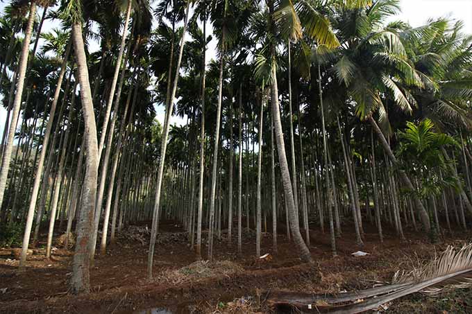
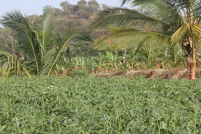
This includes the Attapady Hills (Agali and PuthoorGramaPanchayats) and Attapady Dry Hills (SholayurGrama Panchayat) agro-ecological units and covers the Attapady Block of Palakkad District. The unit covers 27,367 ha (0.71 %)
Climate
The climate is tropical humid monsoon type to sub humid semi arid with mean annual temperature of 24.3 to 27.6 oC and rainfall of 856 to 1482 mm. However, in Agali Panchayat the rainfall is comparatively higher. The dry period extends to 8 months in Attappady Dry Hills, while it is 4 months in other areas.
Soils & Crops
The soils of Attapady Hills of are fertile, near neutral to slightly alkaline clay soils rich in organic matter and bases. Coconut, arecanut banana, cashew, tapioca, vegetables, maize and rice are the major crops. Soils of the valleys have similar characteristics except for impeded drainage conditions
Soil test data of 344 samples collected from the unit indicated that the soils are neutral to moderately alkaline in reaction. Organic carbon content is low to medium, available P low to medium and available potassium medium to high. Deficiency of copper and zinc is observed in 51 and 58 per cent of soil samples respectively.
SOIL REACTION (pH)
- Majority of soils (56 %) are slightly alkaline to moderately alkaline (pH 7.4 to 8.4)
MAJOR NUTRIENTS
- Organic carbon content is low in 62 per cent of samples
- Available phosphorus is low in 41 and medium in 32 per cent of soils
- Available potassium is high in 59 per cent of samples
SECONDARY NUTRIENT STATUS
- Calcium is adequate in 99 per cent of soil samples
- Magnesium is adequate in 90 per cent of soil samples
- Sulphur is adequate in 70 per cent of soil samples
MICRO NUTRIENT STATUS
- Copper is deficient in 51 per cent of soil samples
- Zinc is deficient in 58 per cent of soil samples
- Boron is adequate in 74 per cent of soil samples
ATTAPPADY DRY HILLS
Agro-Ecological Unit
Distribution & Extent
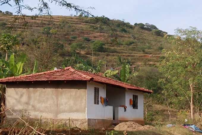
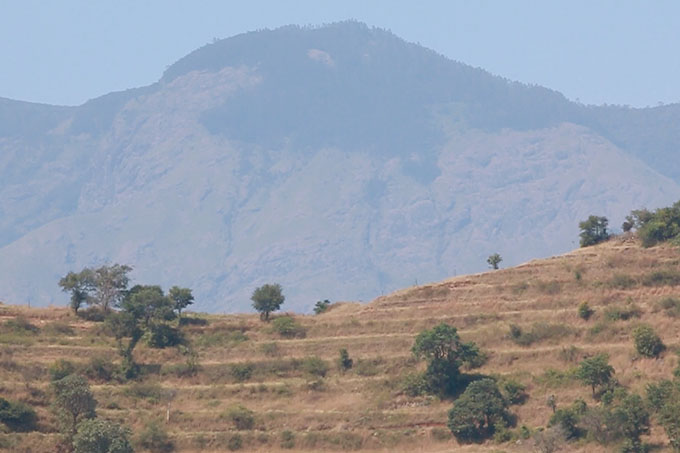
Represents land areas of very low rainfall and dry period
around eight months in a year This unit in the north-eastern
corner of Palakkad district comprises parts of Puthur, Agali
and Sholayur panchayats
The unit covers 18,495 ha
(0.48 %)
Climate
The climate is tropical dry sub humid to semi-arid type Mean
annual temperature 24.7 °C Rainfall 856 mm (mostly during NE
monsoon)
Soils & Crops
The hilly terrain has shallow, slightly acid or neutral, stony
and gravelly clay soils Thorny shrubs with occasional trees are
the dominant land cover
Cultivation of ragi, millet,
banana and rice in low lands of valleys and around tribal
hamlets
Soil test data of 344 samples collected from the unit indicated that the soils are neutral to moderately alkaline in reaction. Organic carbon content is low to medium, available P low to medium and available potassium medium to high. Deficiency of copper and zinc is observed in 51 and 58 per cent of soil samples respectively.
SOIL REACTION (pH)
- Majority of soils (56 %) are slightly alkaline to moderately alkaline (pH 7.4 to 8.4)
MAJOR NUTRIENTS
- Organic carbon content is low in 62 per cent of samples
- Available phosphorus is low in 41 and medium in 32 per cent of soils
- Available potassium is high in 59 per cent of samples
SECONDARY NUTRIENT STATUS
- Calcium is adequate in 99 per cent of soil samples
- Magnesium is adequate in 90 per cent of soil samples
- Sulphur is adequate in 70 per cent of soil samples
MICRO NUTRIENT STATUS
- Copper is deficient in 51 per cent of soil samples
- Zinc is deficient in 58 per cent of soil samples
- Boron is adequate in 74 per cent of soil samples
WAYANAD CENTRAL PLATEAU
Agro-Ecological Unit
Distribution & Extent
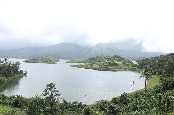
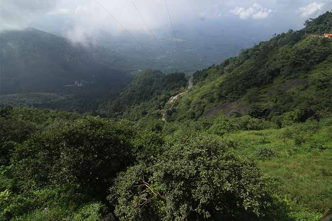
The Wayanad Central Plateau agro-ecological unit covers Kalpetta and Mananthavadi Blocks of Wayanad District. The unit covers 74,471 ha (1.92 %)
Climate
The climate is tropical humid monsoon type with mean annual temperature of 22.6 °C and rainfall 2659 mm.
Soils & Crops
Upland soils are deep, acid clays and are fairly rich in organic matter. Soils of the valley lands are similar in characteristics, but with poor drainage conditions. Soil moisture stress is experienced for three months in a year especially in uplands. Plantations of coffee, tea, coconut, arecanut and pepper are the dominant land use on uplands and rice and banana in lowlands
Soil test data of 4177 samples collected from the unit indicated that majority of soils are extremely acid to very strongly acid. Organic carbon content and available P are high and available potassium medium. Calcium, magnesium and sulphur are deficient in 80, 81 and 70 per cent of soils respectively. Deficiency of copper, zinc and boron is observed in 50, 60 and 94 per cent of samples respectively.
SOIL REACTION (pH)
- Majority of the soils (77 %) are extremely acid to very strongly acid (pH 3.5 to 5.0)
MAJOR NUTRIENTS
- Organic carbon content is high in 53 per cent of samples
- Available phosphorus is high in 73 per cent of soils
- Available potassium is medium in 77 per cent of samples
SECONDARY NUTRIENT STATUS
- Calcium is deficient in 80 per cent of soil samples
- Magnesium is deficient in 81 per cent of soil samples
- Sulphur is deficient in 70 per cent of soil samples
MICRO NUTRIENT STATUS
- Copper is deficient in 50 per cent of soil samples
- Zinc is deficient in 60 per cent of soil samples
- Boron is deficient in 94 per cent of soil samples
WAYANAD EASTERN PLATEAU
Agro-Ecological Unit
Distribution & Extent
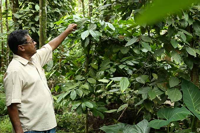
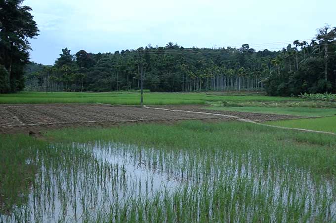
The Wayanad Eastern Plateau agro-ecological unit represents parts of the high land plateau with lower rainfall. The unit covers Panamaram and SulthanBatheri Blocks of Wayanad District. The unit covers 70,325 ha (1.81 %)
Climate
The climate is tropical subhumid to humid monsoon type with mean annual temperature of 22.6 °C and rainfall 1394 mm.
Soils & Crops
Soils of the Wayanad Eastern Plateau are deep, well drained, non gravelly, slightly acid to neutral reaction and are well supplied with bases. Soil moisture deficit is experienced for 4 months in a year. Soils of the valleys have similar characteristics except for impeded drainage conditions. Forest covers a significant area of the unit. Plantations of coffee, tea, coconut, arecanut and pepper are the dominant land use on uplands and rice and banana in lowlands.
Soil test data of 2775 samples collected from the unit indicated that majority of soils are extremely acid to strongly acid. Soils with slightly acid to neutral reaction occur in some areas. Organic carbon content is medium to high, available P high and available potassium medium in soils. Calcium, magnesium and sulphur are deficient in 72, 74 and 56 per cent of soils respectively. Deficiency of copper, zinc and boron is observed in 64, 70 and 61 per cent of samples respectively.
SOIL REACTION (pH)
- Majority of the soils (75 %) are extremely acid strongly acid (pH 3.5 to 5.5)
MAJOR NUTRIENTS
- Organic carbon content is medium 50 and high in 32 per cent of samples
- Available phosphorus is high in 97 per cent of soils
- Available potassium is medium in 65 per cent of samples
SECONDARY NUTRIENT STATUS
- Calcium is deficient in 72 per cent of soil samples
- Magnesium is deficient in 74 per cent of soil samples
- Sulphur is deficient in 56 per cent of soil samples
MICRO NUTRIENT STATUS
- Copper is deficient in 64 per cent of soil samples
- Zinc is deficient in 70 per cent of soil samples
- Boron is deficient in 61 per cent of soil samples
PALAKKAD CENTRAL PLAIN
Agro-Ecological Unit
Distribution & Extent
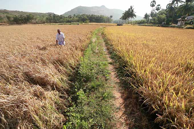
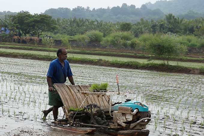
This covers Northern Foot Hills and the Palakkad Central Plain agro-ecological units, distributed in Palakkad central plain and adjacent areas. These units have been merged considering the limited extent of Northern Foot Hills with block as the base unit. It comprises of 45 local bodies in Alathur, Kuzhalmannam, Malampuzha, Mannarkkad, and Nenmara Blocks of Palakkad District. This unit has moderate rainfall and dry period around 5 months and is transitional to the drier eastern plain and humid western part. The unit covers 2,57,138 ha (6.62 %)
Climate
The climate is tropical subhumid to humid monsoon type with mean annual temperature of 27.6 °C and rainfall 1966 mm.
Soils & Crops
Soils are deep, well drained, lateritic, clay to loam texture and are slightly acid or neutral reaction. They are well supplied with bases. The valley soils are have similar characteristics, but with impeded drainage conditions. Coconut intercropped to a variety of annual and perennial crops is the major land use on uplands and rice in lowlands
Soil test data of 6919 samples collected from the unit indicated that majority of the soils are very strongly acid to strongly acid with some areas having slightly acid to neutral soils. Organic carbon content is low to medium, available P is medium to high and potassium is low to medium. Boron is deficient in 51 per cent of soil samples.
SOIL REACTION (pH)
- Majority of the soils (67 %) are very strongly acid to strongly acid (pH 4.5 to 5.5)
MAJOR NUTRIENTS
- Organic carbon content is low in 30 and medium in 48 per cent of samples
- Available phosphorus is medium in 32 and high in 48 per cent of soils
- Available potassium is low in 44 and high in 31 per cent of samples
SECONDARY NUTRIENT STATUS
- Calcium is adequate in 96 per cent of soil samples
- Magnesium is adequate in 80 per cent of soil samples
- Sulphur is adequate in 76 per cent of soil samples
MICRO NUTRIENT STATUS
- Copper is adequate in 96 per cent of soil samples
- Zinc is adequate in 92 per cent of soil samples
- Boron is deficient in 51 per cent of soil samples
PALAKKAD EASTERN PLAINS
Agro-Ecological Unit
Distribution & Extent
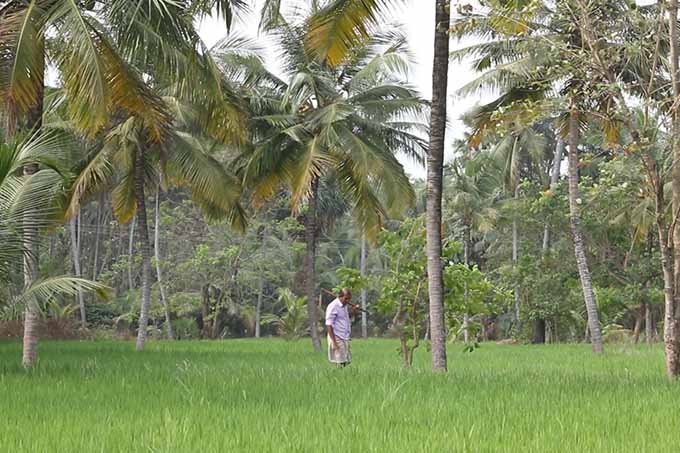
The Palakkad Eastern Plain agro-ecological unit is delineated to represent the drier parts of Palakkad plain in the gap region of Western Ghats, having low rainfall, long dry period. The unit comprises Chittoor and Kollengode Blocks of Palakkad District. The unit covers 47,049 ha (1.21 %)
Climate
The climate is tropical dry subhumid monsoon type with mean annual temperature of 27.6 °C and rainfall 1340 mm.
Soils & Crops
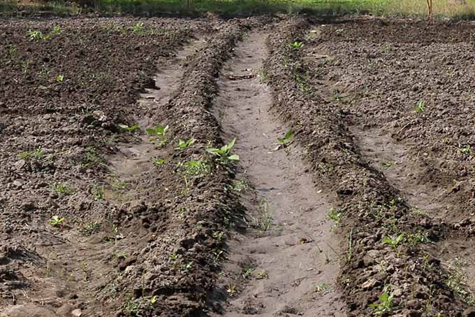
Soils of the uplands are slightly acid to neutral in reaction and are well supplied with bases and plant nutrients. Soils of the lower parts of the uplands and lowlands are swell-shrink clay soils with alkaline reaction. The fertile soils are rich in bases and plant nutrients. Lowlands have similar characteristics with impeded drainage conditions. Soil moisture stress is very severe in uplands and extends for around six months in a year. Coconut, arecanut and mango are the major plantation crops. Rice, groundnut, cotton, banana, maize, jowar and sugarcane are also cultivated in the unit.
Soil test data of 2276 samples collected from the unit indicated that majority of soils are slightly acid to neutral. Organic carbon content is low to medium, available P medium to high and available potassium low to medium in soils. Deficiency of boron is observed in 52 per cent of samples.
SOIL REACTION (pH)
- Majority of the soils (56 %) are slightly acid to neutral (pH 6.1 to 7.3)
MAJOR NUTRIENTS
- Organic carbon content is low in 47 and medium in 46 per cent of samples
- Available phosphorus is medium in 33 and high in 38 per cent of soils
- Available potassium is low in 44 and high in 35 per cent of samples
SECONDARY NUTRIENT STATUS
- Calcium is adequate in 99 per cent of soil samples
- Magnesium is adequate in 98 per cent of soil samples
- Sulphur is adequate in 76 per cent of soil samples
MICRO NUTRIENT STATUS
- Copper is adequate in 95 per cent of soil samples
- Zinc is adequate in 90 per cent of soil samples
- Boron is deficient in 52 per cent of soil samples
Contact Us
+ 91 471 2527567, + 91 471 2700777

© 2019 | System conceived,designed and implemented by IIITMK


